
")
")
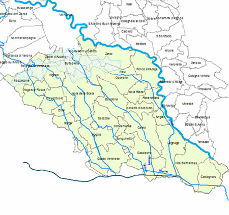 The territory monitored by the Landscape Experimental Local Observatory of the Pianura Veronese stretches from the springs in the north to the rivers Fissero-Tartaro-Canalbianco in the south, from the river Adige in the east (including also the municipal area of Legnago lying on the left bank of the river) to the border with Mantua area in the west. Although the monitored territory offers different landscapes (springs, quarries, marshland reclamations), it is a unified whole both economically and socially. The relevant towns are the following: Angiari, Badia Polesine, Bovolone, Buttapietra, Casaleone, Castagnaro, Castel d’Azzano, Cerea, Concamarise, Erbè, Gazzo Veronese, Isola della Scala, Isola Rizza, Legnago, Mozzecane, Nogara, Nogarole Rocca, Oppeano, Palù, Povegliano Veronese, Ronco all’Adige, Roverchiara, Salizzole, San Giovanni Lupatoto, Sanguinetto, San Pietro di Morubio, Sorgà, Trevenzuolo, Vigasio, Villa Bartolomea e Zevio.
- You are here:
-
Home

-
Observatory
- The territory